Flood Insurance 2.0 (2026 Update): New Rates, New Maps, and What Every Houston Homeowner Needs to Know

Living in Houston, we all know that water is part of the landscape. Whether it’s a summer tropical storm or a sudden “Brazos Bottom” soak, flooding is the single most significant environmental factor affecting our local real estate market. As we move through March 2026, the landscape of how we protect our homes: and what it costs: has shifted significantly.

If you haven’t checked your flood insurance policy lately, you might be in for a surprise. Between the full implementation of FEMA’s Risk Rating 2.0 and the newly released 2026 flood maps for Harris County, the rules of the game have changed. At Bexley Realty Group, we believe an informed homeowner is a protected homeowner. I’m Bill Bexley, and today we’re breaking down exactly what Houston flood insurance 2026 looks like for you.

The Shift: Risk Rating 2.0 and Property-Specific Pricing

For decades, flood insurance was simple, if a bit blunt. You were either “in” a flood zone or “out.” If you were in a high-risk zone (like Zone AE), you paid a high rate. If you were in a “preferred” zone (like Zone X), you paid a flat, low rate.

That era is over. Under FEMA’s Risk Rating 2.0 Houston framework, the agency has moved away from “zones” as the primary driver of cost. Instead, they now use more than 30 different data points to calculate a “Full-Risk Premium” for every individual property.

What are these 30+ data points?

FEMA now looks at:

  • Proximity to water: How close are you to Buffalo Bayou, Cypress Creek, or the Galveston Bay?
  • Elevation: Not just the general neighborhood elevation, but your specific first-floor height relative to the street.
  • Foundation Type: Slab-on-grade foundations are treated differently than pier-and-beam homes.
  • Cost to Rebuild: A 4,000-square-foot custom home in River Oaks will have a different risk profile than a 1,200-square-foot cottage in Lindale Park.
  • Frequency of Flooding: Historical data is now integrated more deeply into the algorithm.

This means that two houses on the same street could have different premiums based on their unique characteristics.

The 2026 Map Updates: What Changed?

While Risk Rating 2.0 changed the pricing, the 2026 Flood Insurance Rate Maps (FIRMs) changed the requirement. In early 2026, FEMA finalized several “Pending” databases for the Houston area. These maps categorize risk levels as “undetermined,” “moderate,” or “high risk.”

The biggest takeaway for 2026? Flood zones Harris County 2026 updates have expanded the “high-risk” boundaries in several growing corridors, particularly in the Katy and Cypress areas where recent development has altered natural drainage patterns.

However, there is a nuance most people miss: The updated maps do not automatically change your insurance premium under the new system, but they do trigger mandatory insurance requirements from mortgage lenders. If your home was recently reclassified into a high-risk zone, your lender will likely require you to carry coverage where they didn’t before.

If you are looking to buy, it is essential to check Homes in low flood zones Houston to ensure you aren’t walking into an unexpected mandatory expense.

One of the most common questions I get at Bexley Realty Group is: “Bill, my home hasn’t flooded, so why did my premium go up 18% this year?”

The answer is the “Glide Path.” Under federal law, FEMA cannot increase most primary residence premiums by more than 18% per year. However, because Risk Rating 2.0 identified that many Houstonians were paying far less than their “true risk” for years, FEMA is now incrementally raising those rates until they reach the Full-Risk Premium.

For example, if FEMA determines your “true” cost should be $4,500, but you were only paying $1,200, you will see an 18% increase every single year until you hit that $4,500 mark. You can find your specific Full-Risk Premium on your annual renewal letter. If that number is significantly higher than your current payment, you should budget for these annual hikes for the foreseeable future.

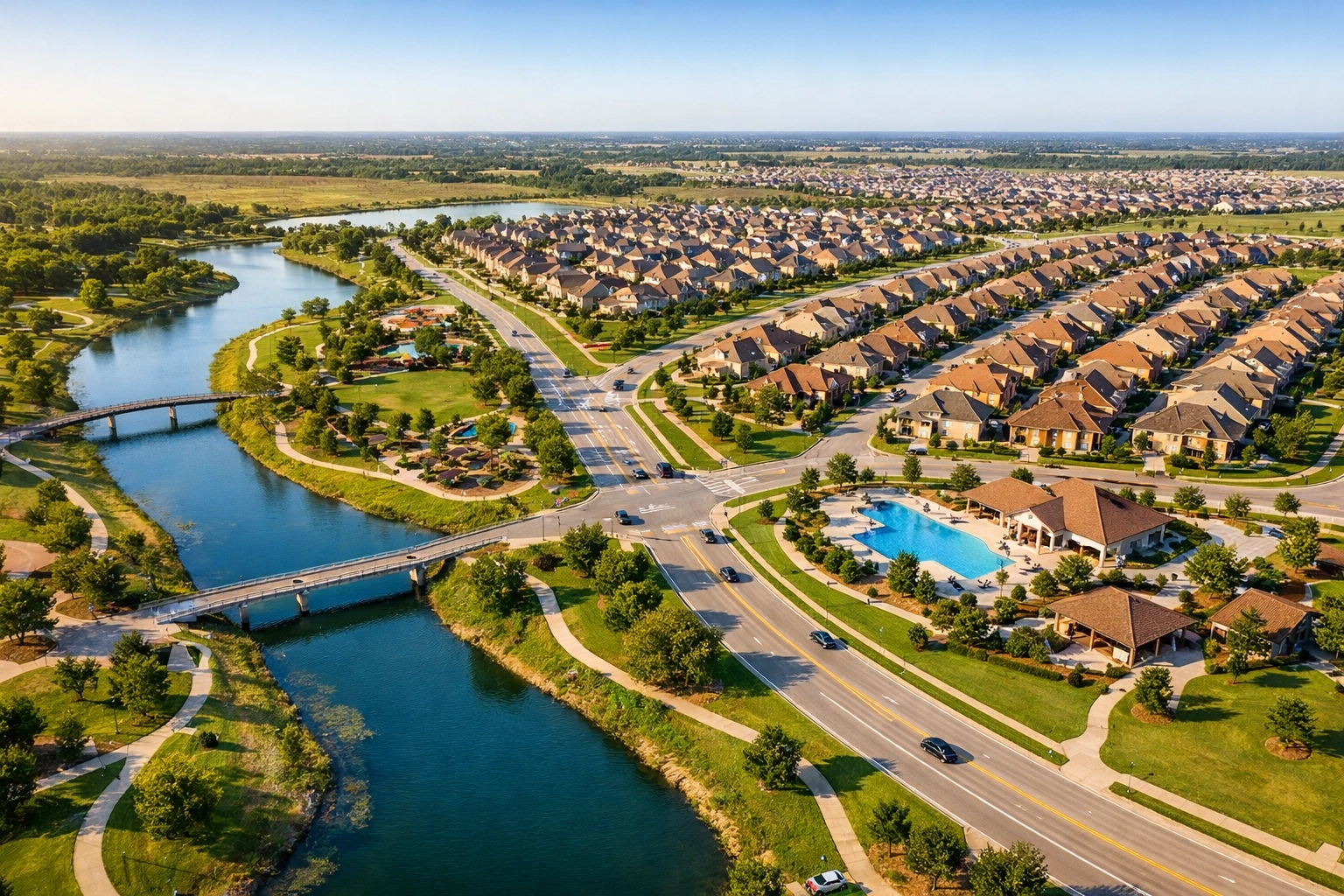
Average Flood Insurance Costs in Houston (2026)

So, what are people actually paying? As of early 2026, the flood insurance costs Houston homeowners are seeing vary by county and risk profile. Here is a breakdown of average annual NFIP costs in our region:

Keep in mind that properties in high-risk zones (AE, AH, VE) are generally paying between $900 and $1,200 more than those in moderate-to-low-risk zones. For more detailed information on the National Flood Insurance Program, you can visit the official FEMA.gov or National Flood Insurance Program websites.

Impact on Houston Real Estate and Home Values

As a Managing Partner at Bexley Realty Group, I’ve seen firsthand how Houston real estate climate risk is becoming a standard part of the negotiation process. In 2026, a high flood insurance premium is essentially treated like a higher property tax rate or an expensive HOA fee. It affects a buyer’s “debt-to-income” ratio and their overall purchasing power.

For Sellers:

If your home is on the “Glide Path” toward a high premium, it can affect your bottom line. Prospective buyers are more savvy than ever; they will ask for your current policy and your full-risk premium. When calculating What Are Closing Costs for Sellers in Houston?, you must account for how your home’s flood history and current insurance status might influence your final sale price.

For Buyers:

Before you fall in love with a kitchen, check the elevation. We highly recommend every buyer consult The Complete Houston Home Buyer’s Handbook to understand how to factor insurance and climate risk into an offer. A “cheap” house in a high-risk zone might end up costing you an extra $400 a month in insurance: effectively reducing your mortgage budget by $50,000 or more.

Private Flood Insurance: Is It a Better Deal?

Many Houstonians are looking to “exit” the NFIP and move toward private insurance carriers. Private insurance can sometimes offer lower rates and higher coverage limits (the NFIP caps at $250,000 for the structure).

However, there is a catch. Private carriers are highly selective. In Harris County, their appetite for risk looks roughly like this:

  • 0 Prior Claims: You are a prime candidate for private insurance.
  • 1–2 Prior Claims: You may qualify, but your rates will be higher.
  • 3+ Prior Claims: You are likely "uninsurable" in the private market and must stay with the NFIP.

Warning: If you leave the NFIP for a private policy and later decide to return, you may lose your “subsidized” status. This could jump your rate immediately to the Full-Risk Premium instead of staying on the 18% Glide Path. Always consult with a specialist before making the switch.

Strategies for Homeowners: How to Lower Your Risk (and Rate)

You aren’t necessarily stuck with a high premium. There are ways to mitigate your risk and potentially lower your 2026 rates:

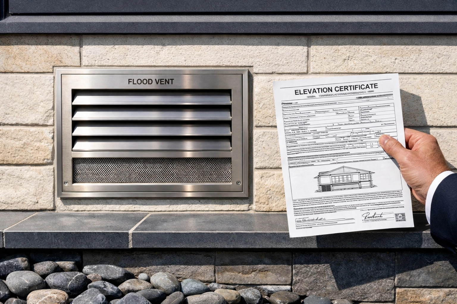
  • Elevation Certificates: While not always required under 2.0, a private elevation certificate can sometimes prove your home is higher than FEMA’s satellite data suggests, leading to a lower rate.
  • Flood Vents: For homes with crawlspaces or garages, installing FEMA-compliant flood vents can significantly reduce your premium.
  • Grandfathering: If you are selling your home, your NFIP policy can often be assigned to the new buyer. This allows them to keep your current rate and your 18% Glide Path rather than jumping to the full-risk rate immediately. This is a massive selling point!

Navigating the 2026 Market with Bexley Realty Group

The intersection of insurance, climate risk, and property value is the new reality of Houston real estate. Whether you are looking for a Bexley Home Valuation tool to see how your home stacks up in the current market, or you want to stay updated on Houston Real Estate Market Trends, our team is here to help.

We don’t just sell houses; we help you navigate the complexities of living in a coastal-adjacent metroplex. From analyzing the new 2026 maps to helping you find a home with a manageable risk profile, Bexley Realty Group is your partner in Houston real estate.

Summary & Key Takeaways

  • Risk Rating 2.0 is now the standard, pricing homes based on individual risk rather than just map zones.
  • The 18% Glide Path means many homeowners will see annual increases until they reach their "Full-Risk Premium."
  • 2026 Map Updates have expanded mandatory insurance requirements in several Houston suburbs.
  • Private insurance is an option for homes with no claim history, but it comes with risks if you try to return to the NFIP.
  • Grandfathering (policy assignment) is a powerful tool for sellers to maintain home value.

Don’t let the 2026 updates catch you off guard. If you’re concerned about how these new rates affect your home’s value or your ability to buy in a specific neighborhood, let’s talk.

Contact Bexley Realty Group today at 832-648-2492 or visit BexleyRealtyGroup.comto start your journey with a team that knows Houston inside and out.

#HoustonRealEstate #HoustonFloodInsurance #HarrisCounty #RealEstate2026 #FEMA #HomeBuyingHouston #BexleyRealtyGroup